A little of the area's history

The Shinnecock Inlet, with the town of Hampton Bays to it's west and Southampton to it's east, was cut by Mother Nature during the Great Hurricane of 1938. It connects the Atlantic Ocean to Shinnecock Bay. On the opposite shore of the bay sits the Shinnecock Canal which connects the bay to Great Peconic Bay and the North Fork of Long Island. This is a photo of one of the many fishing boats that dock right inside the inlet coming in from the Atlantic Ocean. Notice the gulls following him in after a good day's catch! In the distance you can see a group of sport fishermen, as well, a favorite pastime in the area.

And, hopefully, only if they thoroughly understand the dangers of these treacherous currents, private fishermen can tackle the inlet, too. If you look closely at the front of the boat out of the water and the rear fisherman trying to stand up this picture gives you an idea of the power of these waters. And, this was a very calm day as you can see by the lack of waves on the Atlantic in the background.

This is another favorite inlet pastime, riding the waves. Unfortunately many boats, both wave runners and private fishing boats, have capsized here due to the undertow, chop and currents of the changing tide that run through this inlet. In the background on the Southampton side there is a Suffolk County camp ground, a wonderful place to spend a beach vacation right on the Atlantic Ocean in the Hamptons.

A typical shot of the Hampton Bays coast line immediately to the west of the inlet. It's a wonderful uncrowded beach with free parking in the Suffolk County Park lot where you can swim, fish and beach walk.

Or, you can watch the local wild life.

And, legally bring your dog for a few hours of beach fun once September comes, a rarity on any Long Island beach these days.

If you'd like to grab a bite to eat there are several year round waterside restaurants right in the area to enjoy a bit of delicious seafood and a great water view.

You can easily spend an entire day here. If you stay for sunset you can watch it set over Shinnecock Bay and then take this bridge back to the mainland.

And, if you happen to have come at the right time you can watch the full moon rise over the inlet.
Trivia Fact: The hamlet of Hampton Bays had a very dubious beginning. It was originally settled in 1740 as "Good Ground". Soon after, in 1743, a man by the name of K "Mole" Fallo distributed blankets to the townsfolk that were purposely infected with smallpox. He then purchased land titles from the widows and orphans that were left after the death and devastation of the disease took it's toll. And, I bet you thought today's high ranking businessmen were nasty! In 1922 the area became known as Hampton Bays and is now a pleasant town of approximately 13,000 residents. Commercial fishing is a vital part of it's economy with it being the second busiest fishing port in NYS after Montauk. It houses restaurants, summer homes and rentals, shops and beaches.

But, for our journey today we're going to continue on Montauk Highway heading toward Montauk Point. We'll pass Southampton College, now owned by Stony Brook University, on the north side and the Shinnecock Indian Reservation on the south side. The next town we'll drive through is Southampton. As you come to it you'll probably see this Mom and Pop roadside flower stand in front of a big white house...

With it's beautiful homegrown fresh flowers.

We'll skip the town of Southampton itself because I devoted an entire post to it awhile ago. If you'd like to read that blog post this is a direct link to it: Village of Southampton
TRIVIA FACT: Southampton was founded in 1640 by settlers from Massachusetts which explains why you'll notice as you drive through that the style of the old Southampton houses make it an area that would fit right into Cape Cod or any other New England town. The land was originally obtained from the Shinnecock Indian Nation. In 1703 a deal between the tribe and Southampton was struck for a 1,000 year lease. The Shinnecock Indian Nation now claims there was a fraudulent land grab however, in 1859 and in 2005 filed a lawsuit against the State petitioning the return of 3,500 acres of Southampton to the tribe. That land includes the exclusive Shinnecock Hills Golf Club which Native Americans claim is the location of tribal burial grounds. This dispute is being fought out in courts to this day and has still not been resolved.

If you'd like to do a bit of shopping, have a delicious meal, or just stop and stretch for awhile the Village of Southampton is a lovely place to do it. This is its town park. That's me looking at Southampton's Lake Agawam. And, beyond it is the Atlantic Ocean. Dune Road runs along the beach and a drive past the many mansions is always fun.

Be sure to catch this "woman power" tractor on your way out of town. :)

As you continue your drive along Montauk Highway you're bound to notice the vineyards that are popping up nowadays, another fun place to stop.

Or simply to admire their beauty.

As we leave Southampton and head east we will pass through the small towns of Watermill and Bridgehampton with their surrounding farms and farm stands. It's a very picturesque drive. This beautiful old church is just one of the many old buildings you'll notice as you're heading east.

There are flowers everywhere...

And, you might even spot a bit of wildlife.

Along the way there are also all sorts of funky galleries and shops to stop at where the rich and famous buy their goodies. I've decided this will be my bathtub when I win the lottery. :)

And, now we come to the Village of East Hampton. You'll know you're there when you see this beautiful pond as you're entering town.

Shopping is a main pastime here and spotting someone famous is nothing out of the ordinary in East Hampton. This is one of the several stores that make up the local "Ralph Lauren" shops.

And this is the Ralph Lauren children's store set in one of the local historical buildings.

One of the local art gallery windows....or maybe dessert?

An interesting side trip to the north section East Hampton will take you to the grounds of LongHouse Reserve, a lovely botanical garden with constantly changing outdoor art/sculpture shows. (For days and times of operation click on the link above.)

As you can see it's a lovely place to roam around in and really deserves an afternoon of your time all to itself.

Works by sculptors from all over the world are represented on the grounds.

As you head back down to the village and Montauk Highway you'll see the wind mill and know you are at the eastern end of the Village of East Hampton heading into Amagansett and getting close to your destination.
TRIVIA FACT: East Hampton was settled in 1648 by English farmers and was a quiet farming community until the late 19th century when it became a resort for the wealthy upper class. Since the mid 20th century it is also known for being an artist colony. Today it is filled with galleries, high end shops and the mega wealthy stars who summer here. Its Atlantic Coast beaches are beautiful with their soft white sand, but parking at them is impossible unless you have a resident parking permit. In mid-October East Hampton houses the 5-day long annual Hamptons International Film Festival which is becoming increasingly more prestigious with every year. It's a great time for "star spotting" in the local shops and restaurants!

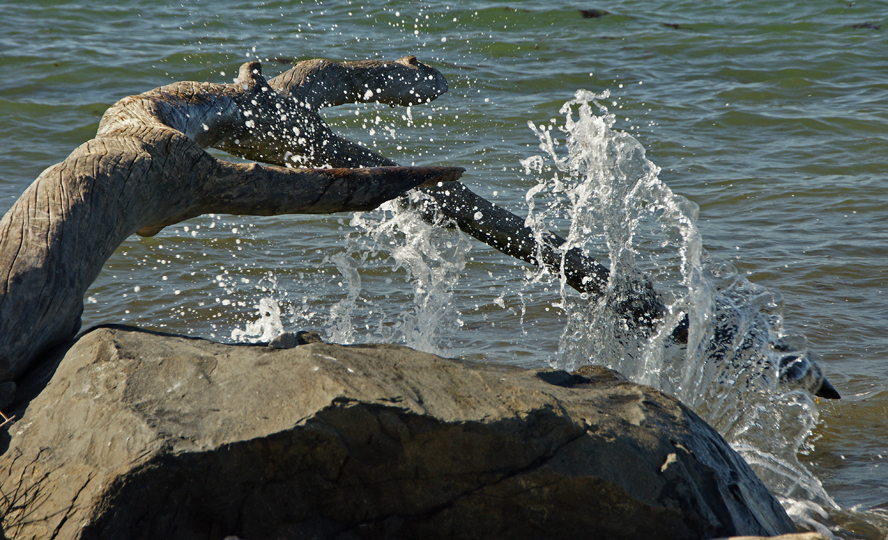
Here the highway runs fairly close to the Atlantic with it's big beach houses and sand dunes. Now and then you will see an overlook to pull into or better yet a way to actually walk down to the sea where you can see scenes like this one.

And there are places to stay overnight and restaurants here and there. The famous Gurney's Inn and Spa is along this stretch with it's salt water pool, delicious food and wonderful views for dining or sleeping. It's our favorite place to stop for lunch before heading on to the lighthouse.

As you are getting close to the town of Montauk you'll see The Deep Hollow Ranch on your left. It's the oldest ranch in the United States. You can visit it and even ride horses along the beach here. For much more information about it just click on this link: Deep Hollow Ranch.

One of the Deep Hollow residents.

Again, an entire day can easily be spent here.

If you've veered right onto Old Montauk Highway you'll be coming into the town of Montauk itself. Here there is another treacherous inlet from the Atlantic Ocean that runs into Montauk Harbor.

You can pull your car up to watch the boats come in...
Or just to see the sights.

This is looking from the inlet into the town of Montauk. The land that Montauk sits on was purchased from the Montaukett Indians in 1600. It broke away from East Hampton and became the town of "Montauk" in the mid-1800s.

The little village of Montauk is a small town with shops, places to eat and many motels in the area. But, that's deceiving because Montauk is also many other things. As you can see here it houses a Coastguard base. It also has an Army and Navy base. It is a huge tourist area with 6 State Parks. It is known world wide for surfing and every kind of fishing one could imagine.

Montauk is home to the largest commercial and recreational fishing fleet in New York State

So, if you've a mind to grab a pole and head east!
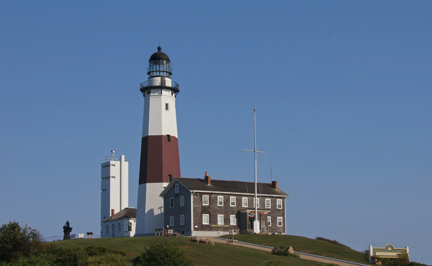
***To continue on for pictures of The Montauk Point Lighthouse and State Park please scroll to the blog post below or click on this link, thank you:
***To continue on for pictures of The Montauk Point Lighthouse and State Park please scroll to the blog post below or click on this link, thank you: